Paraíba, Brazil | A river-meets-sea beach on the South Coast

Praia Bela - Pitimbu

This is a non-profit educational guide to Praia Bela. It focuses on the beach's geography, river-and-sea ecology, how to get there, and on-site photos, without bookings, promotions, or commercial endorsements.

Key facts

Geography, history and place context

The appeal of Praia Bela comes from more than the sand. The river, the coast, the dunes, and the local community together form a single visiting context.

Landscape
river-meets-sea, golden sand, reefs and mangroves
Experience
beach leisure, river swimming, small-boat crossing
Regional setting
southern edge of the João Pessoa metro area, Pitimbu
Best for
road-trippers, families, nature photographers, eco-observers

River-meets-sea landform

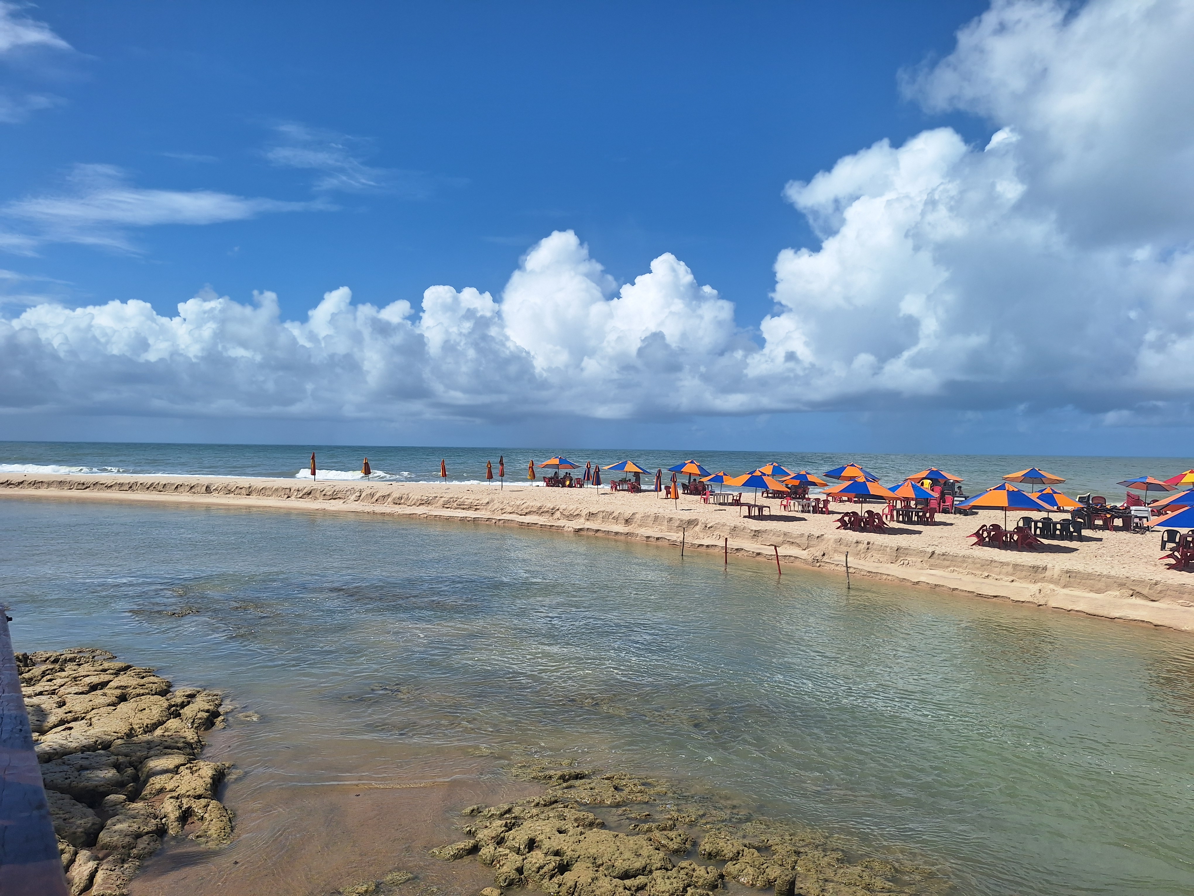
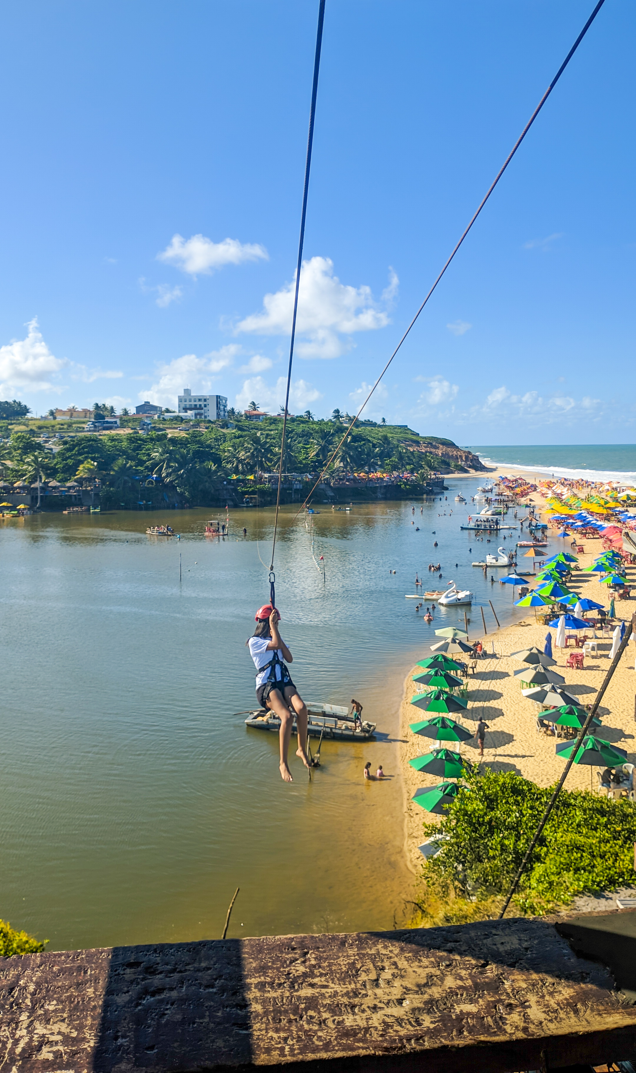
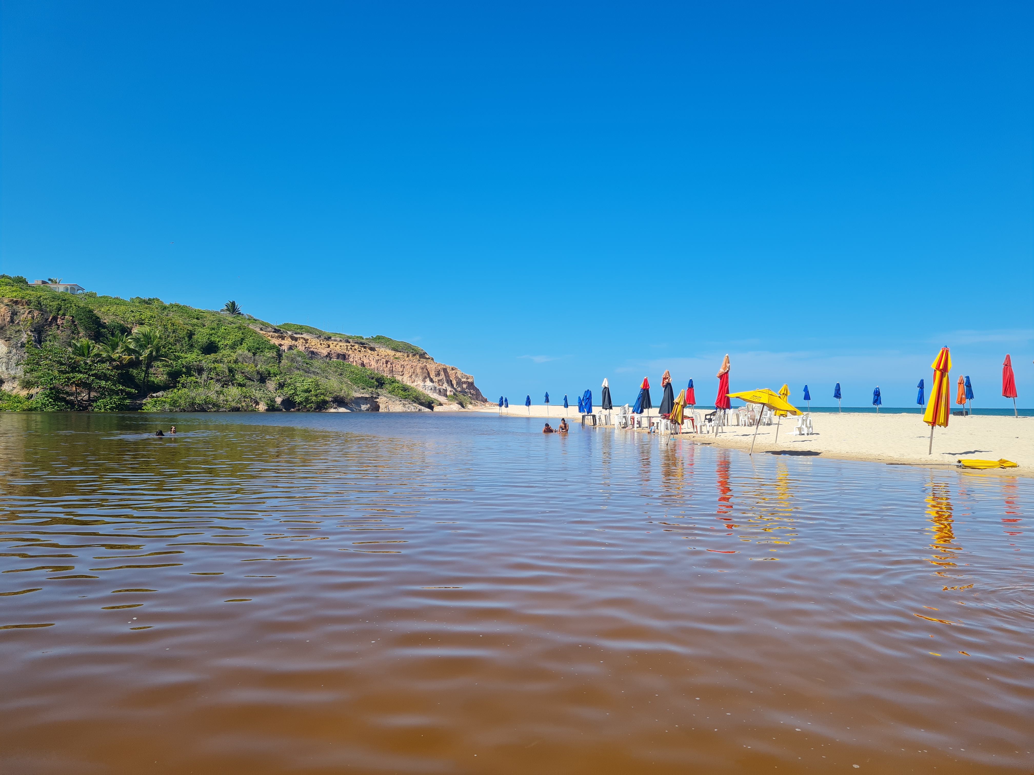
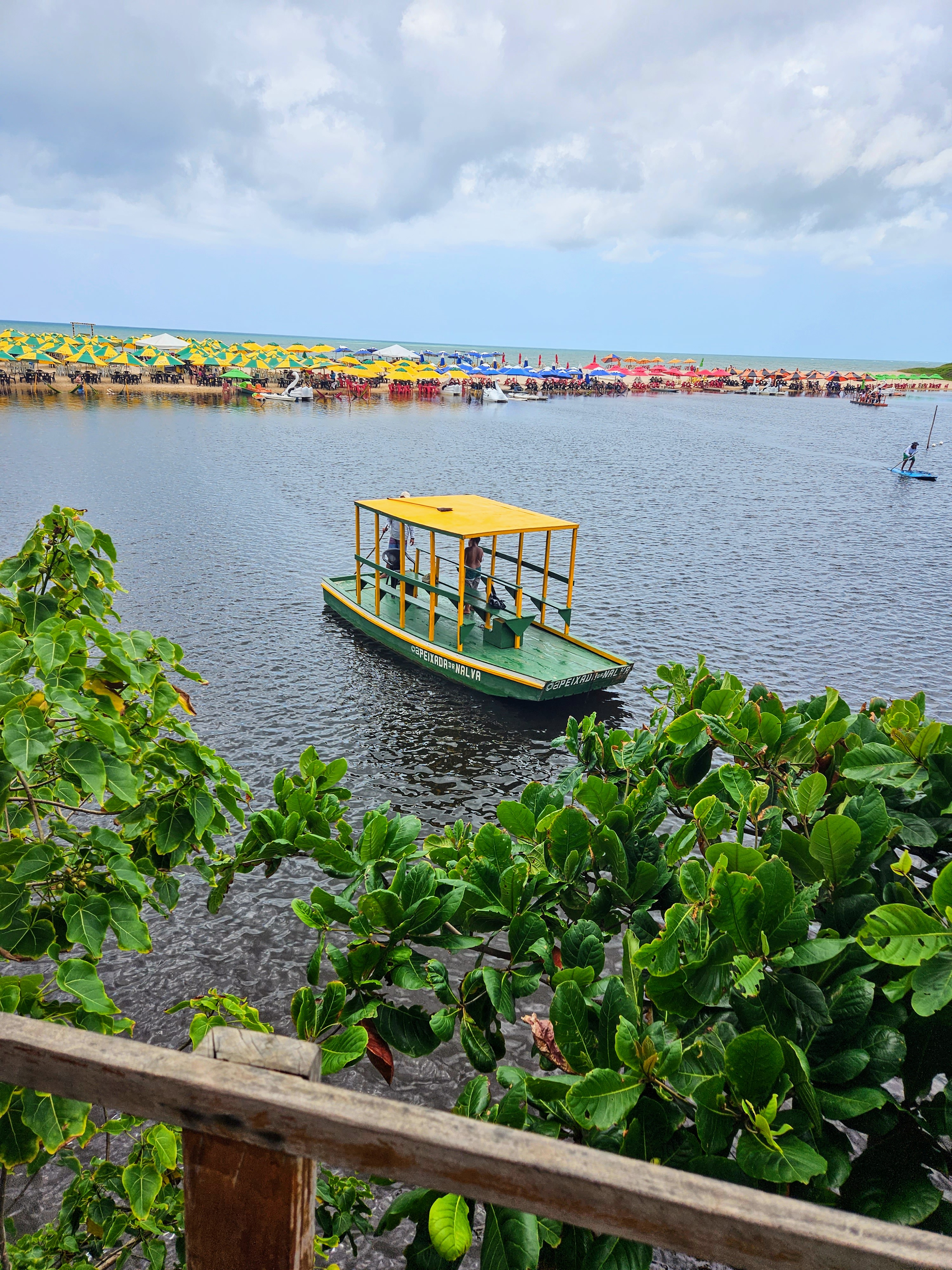
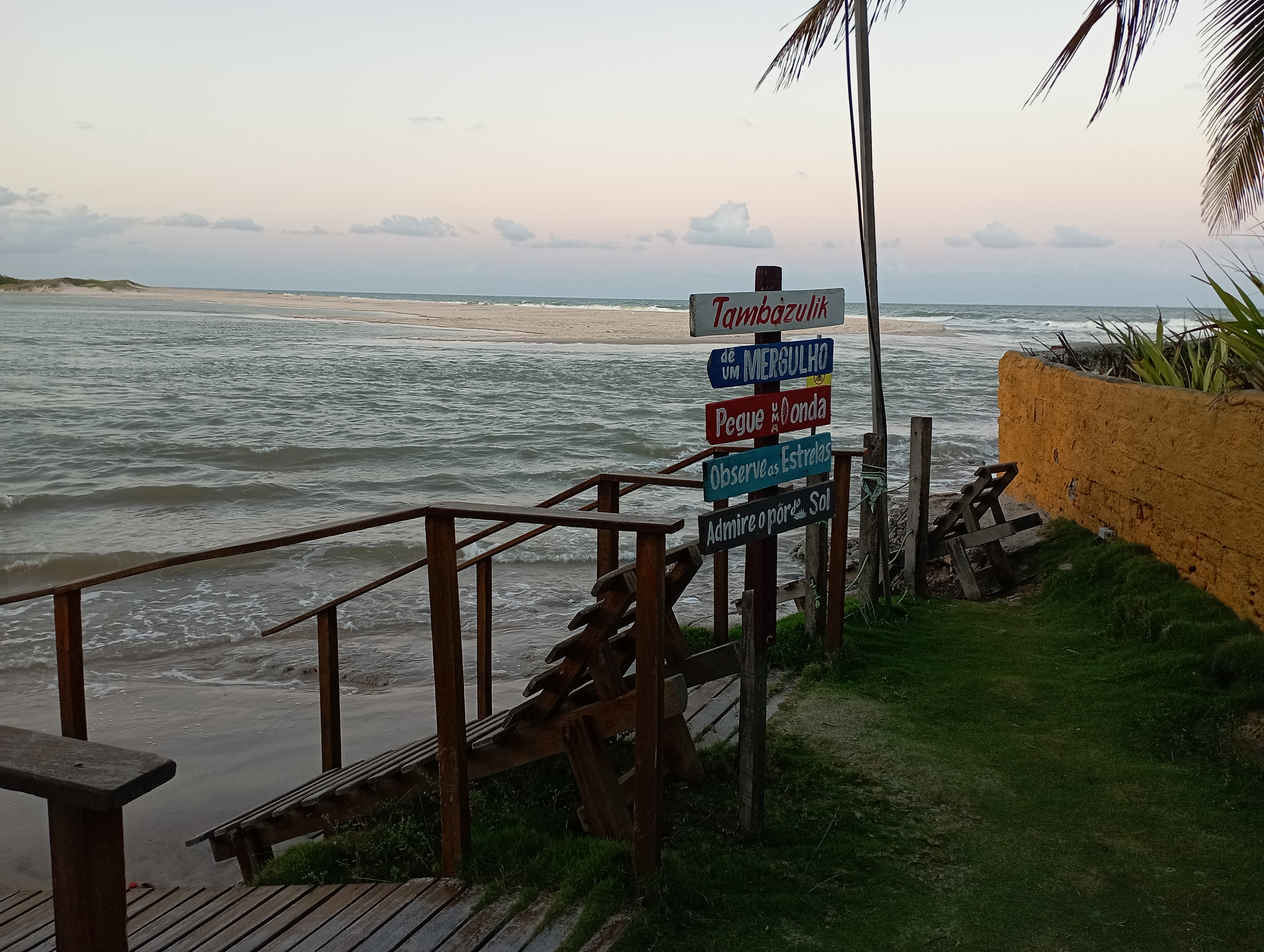
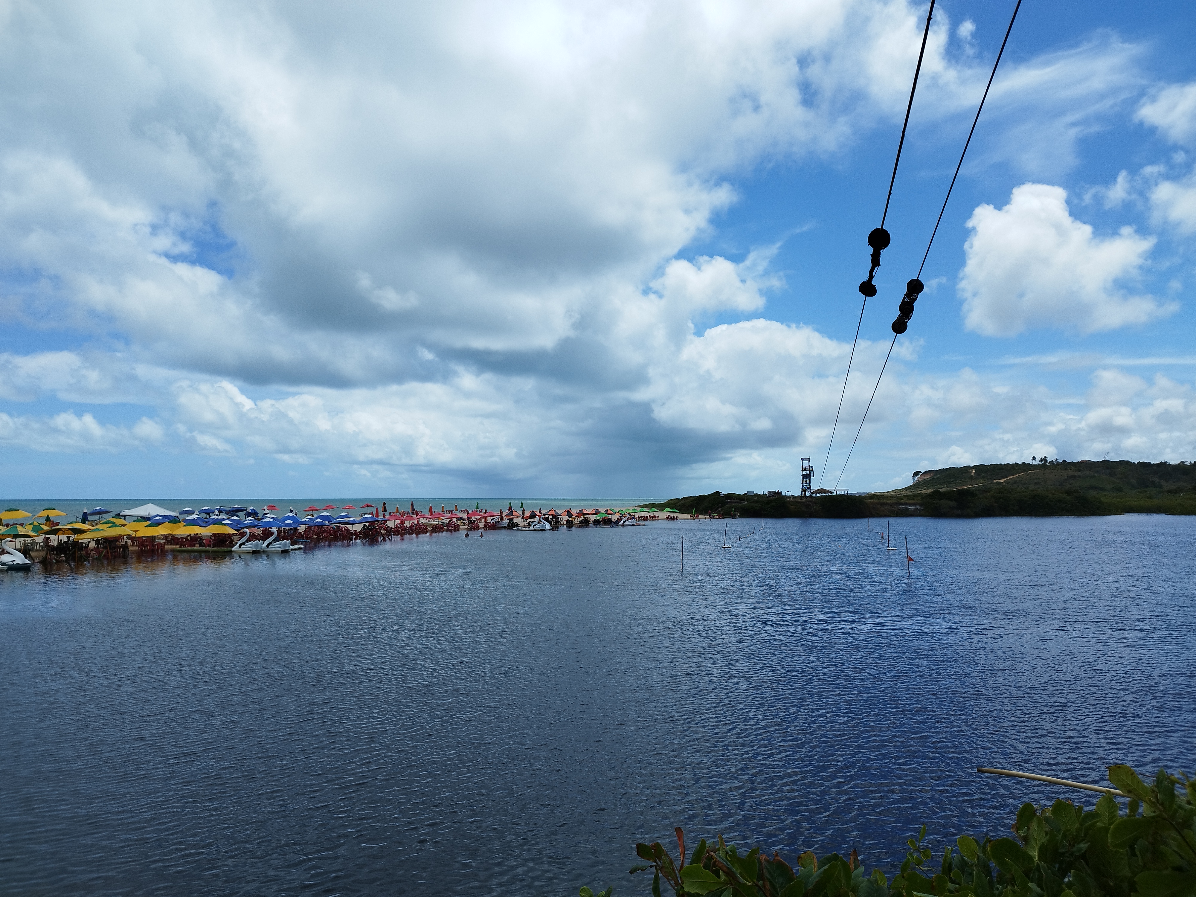
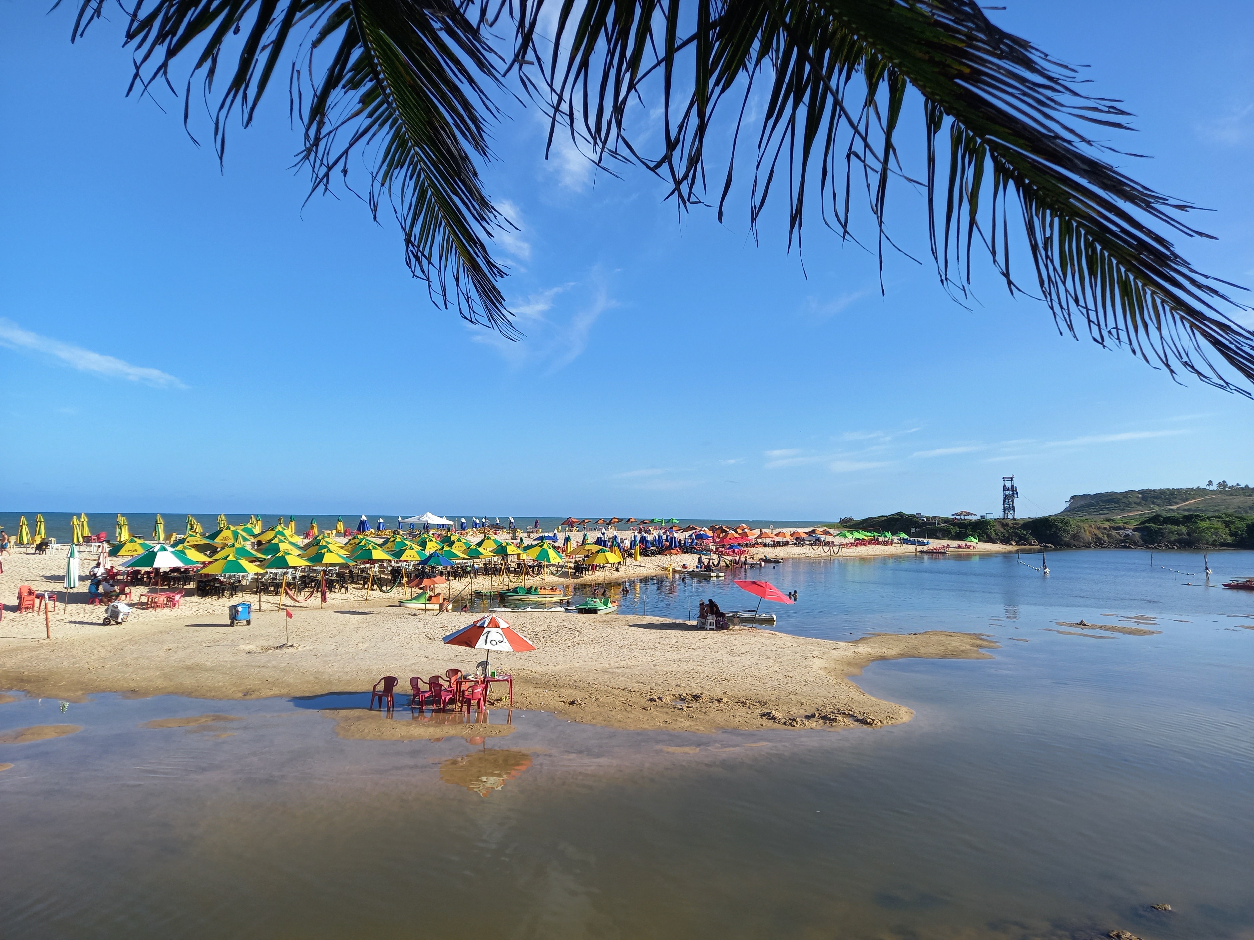
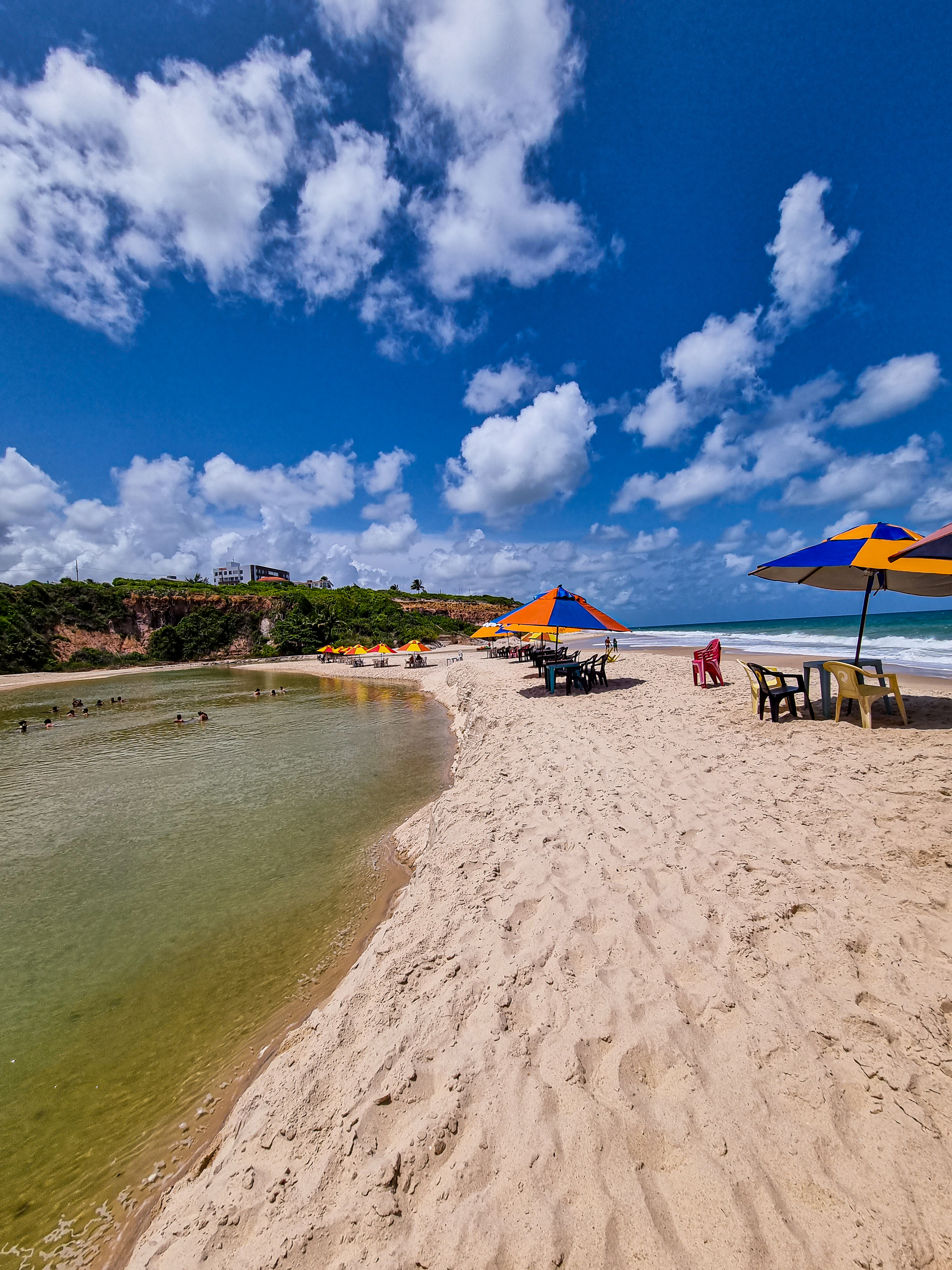
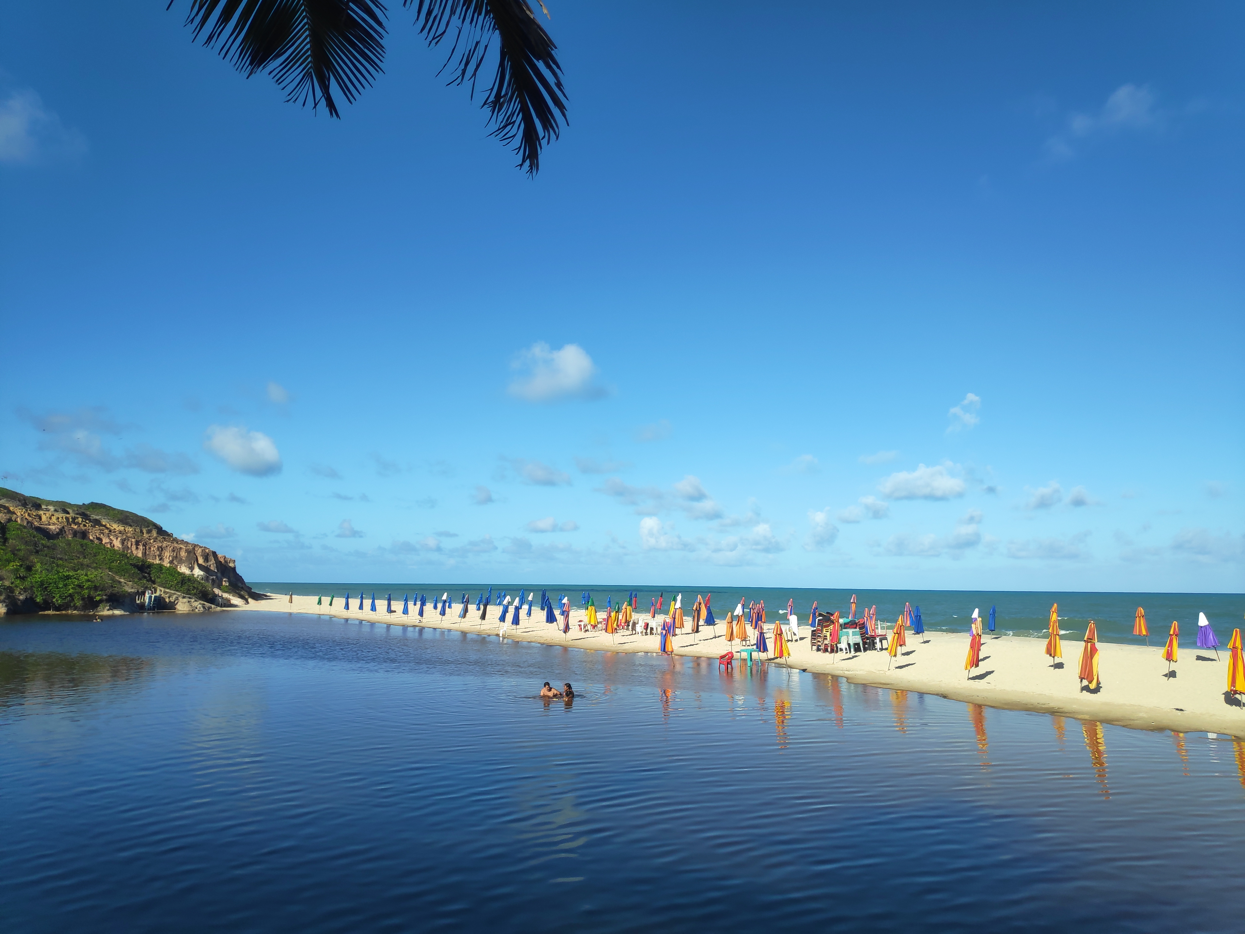
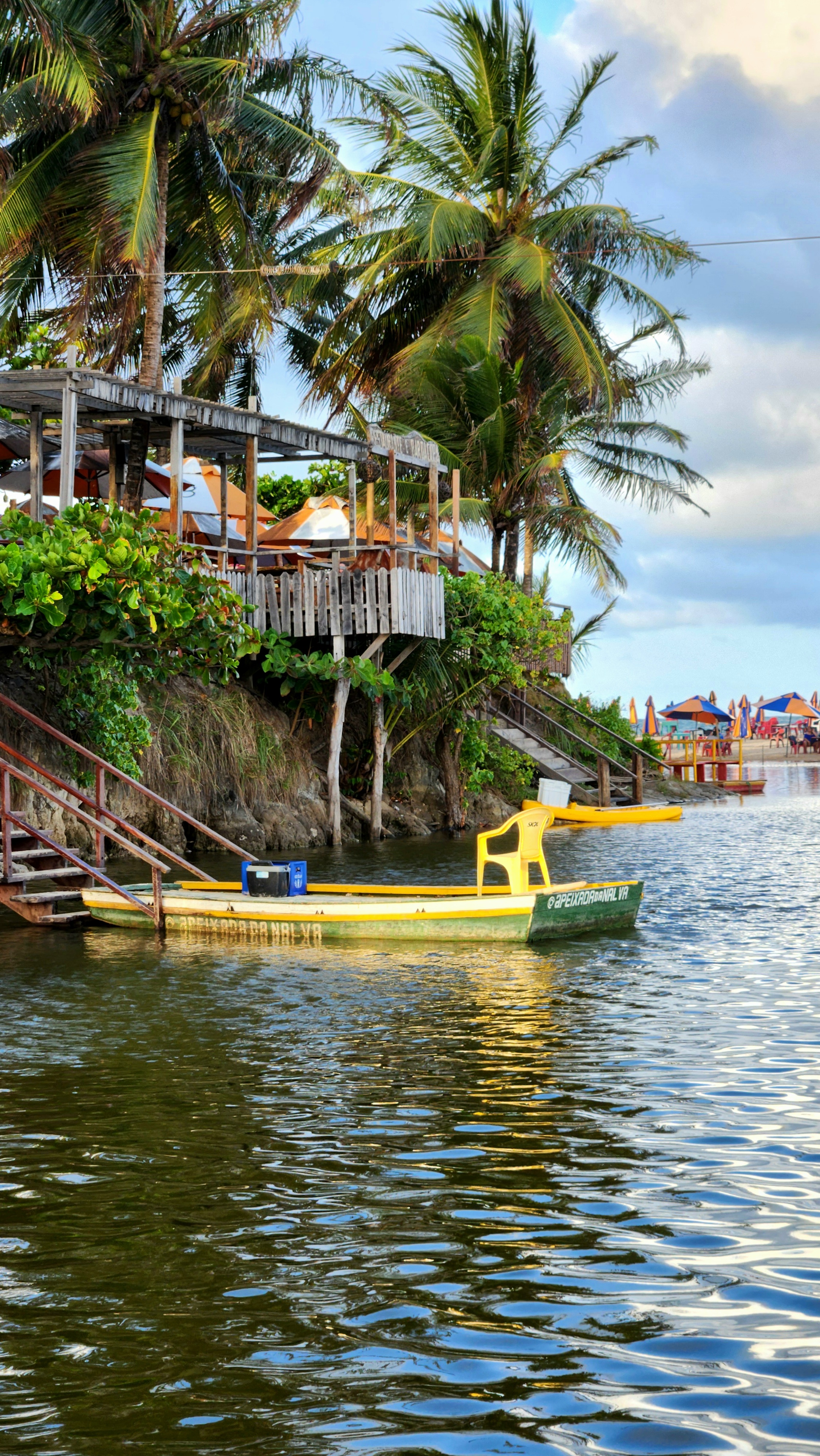
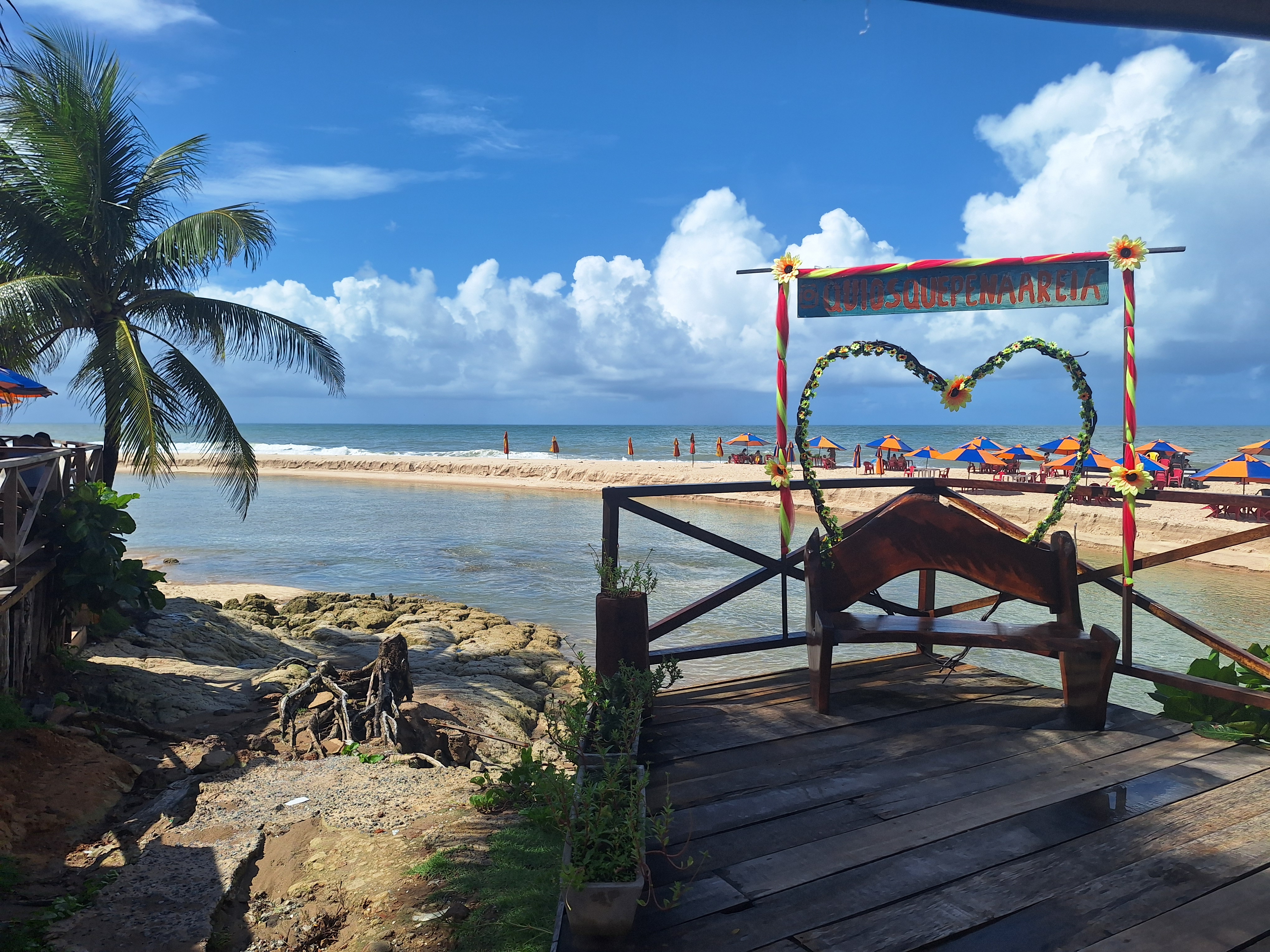
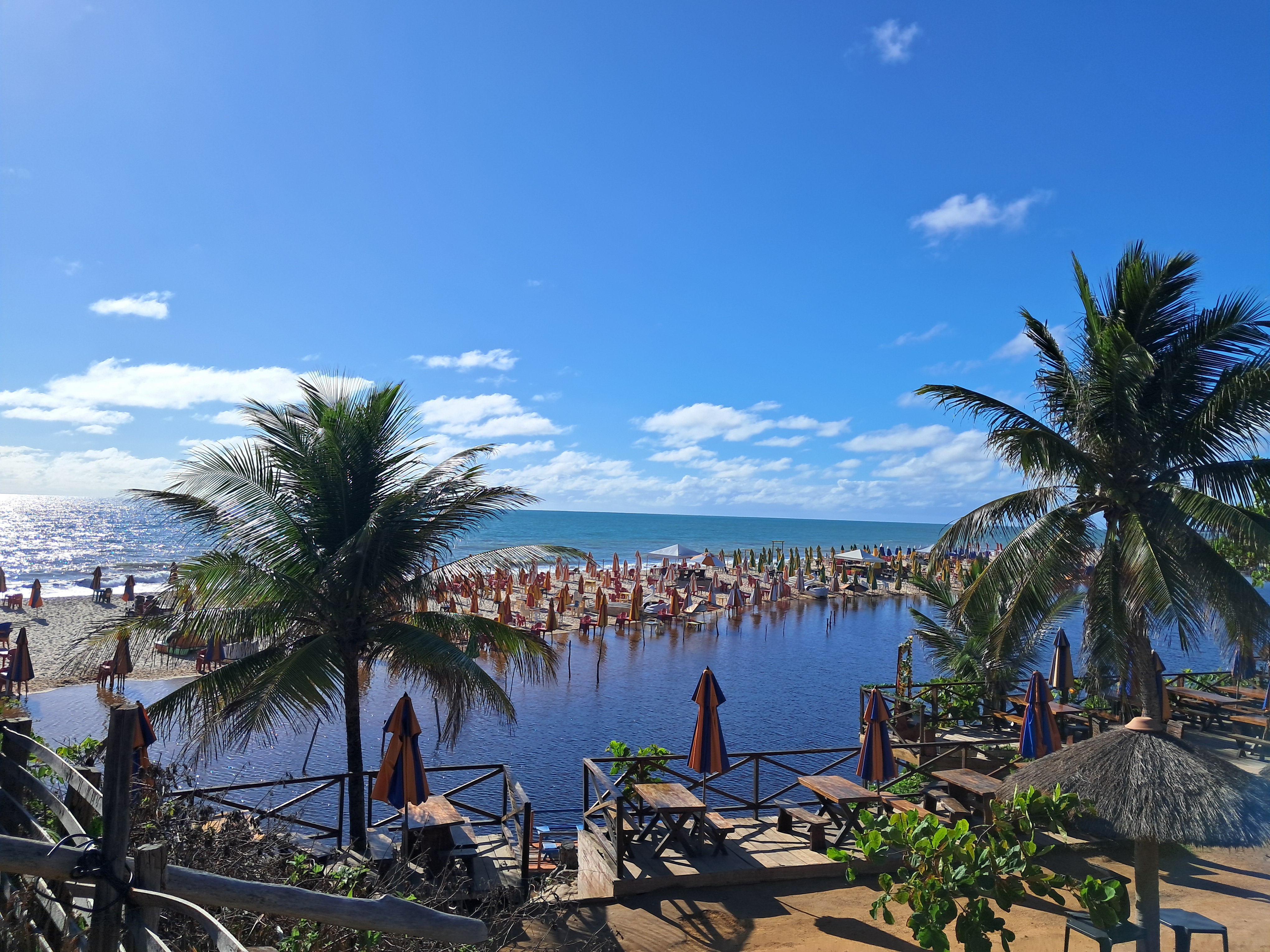
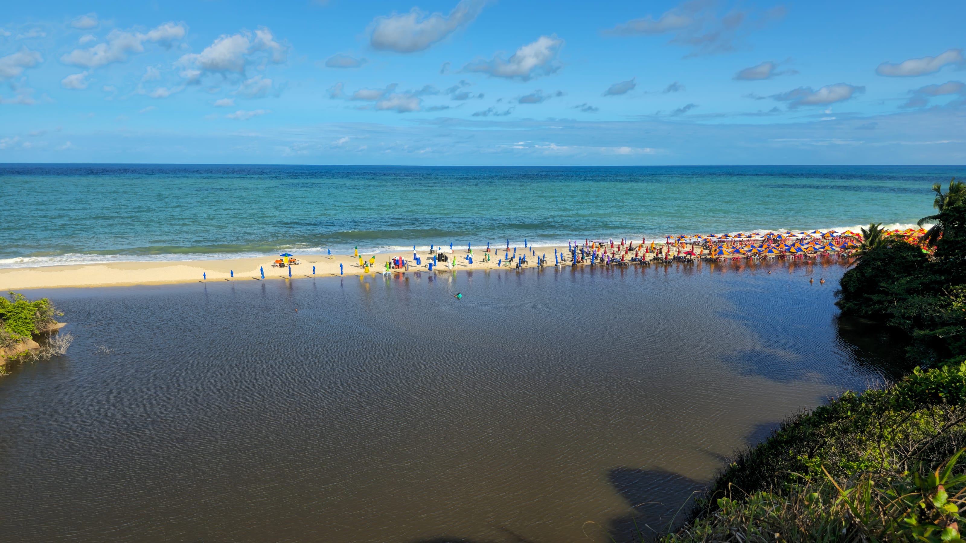
Praia Bela sits on the Atlantic coast of southern Pitimbu. A small river mouth enters the sea here. This river-meets-sea setting creates its most distinctive experience: a warm, calm river on one side and a cooler, wavier open sea on the other. Reaching the beach usually means crossing the river mouth by a small ferry (balsa), a local tradition that continues today.

Coast, dunes and vegetation

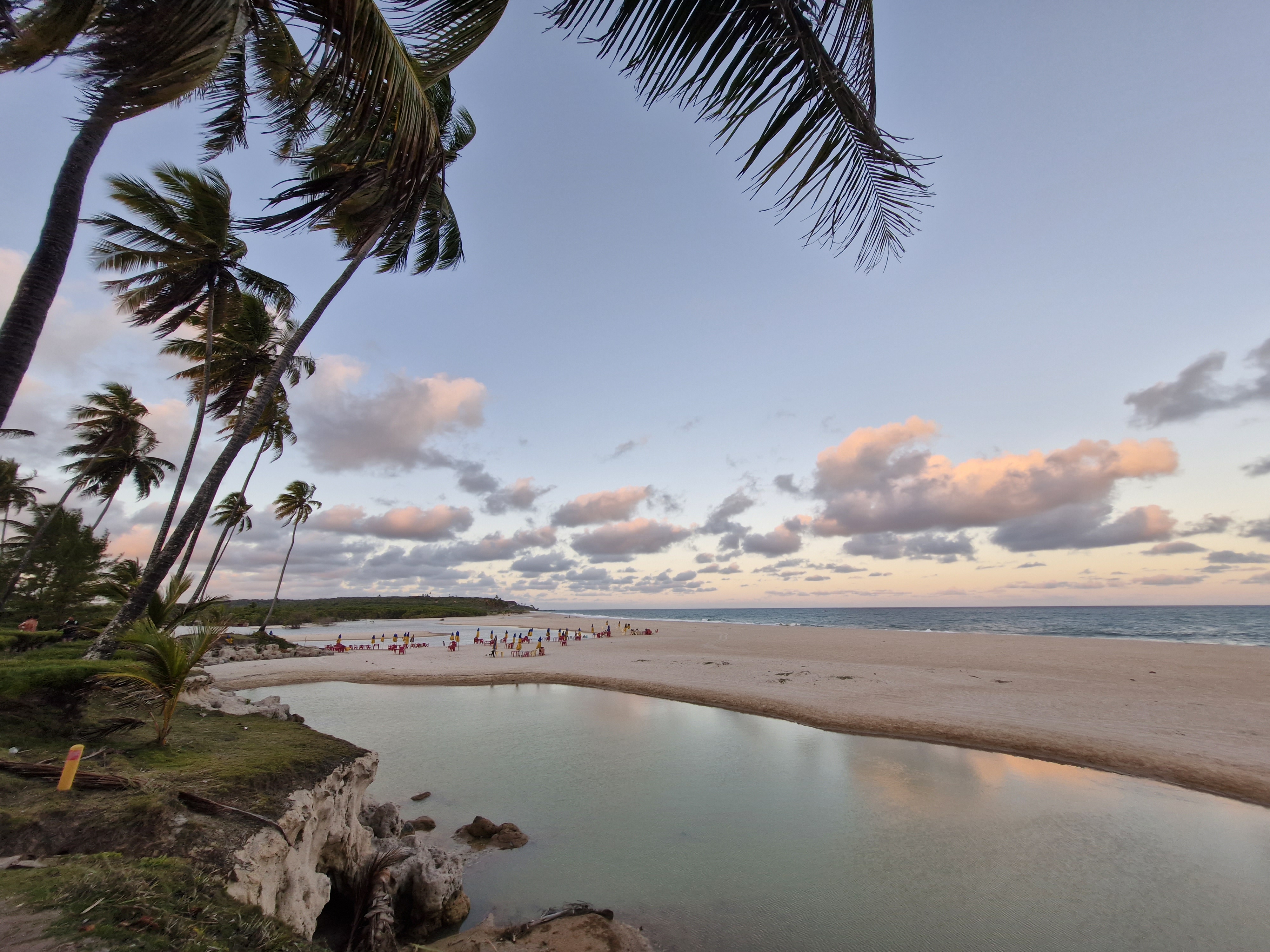
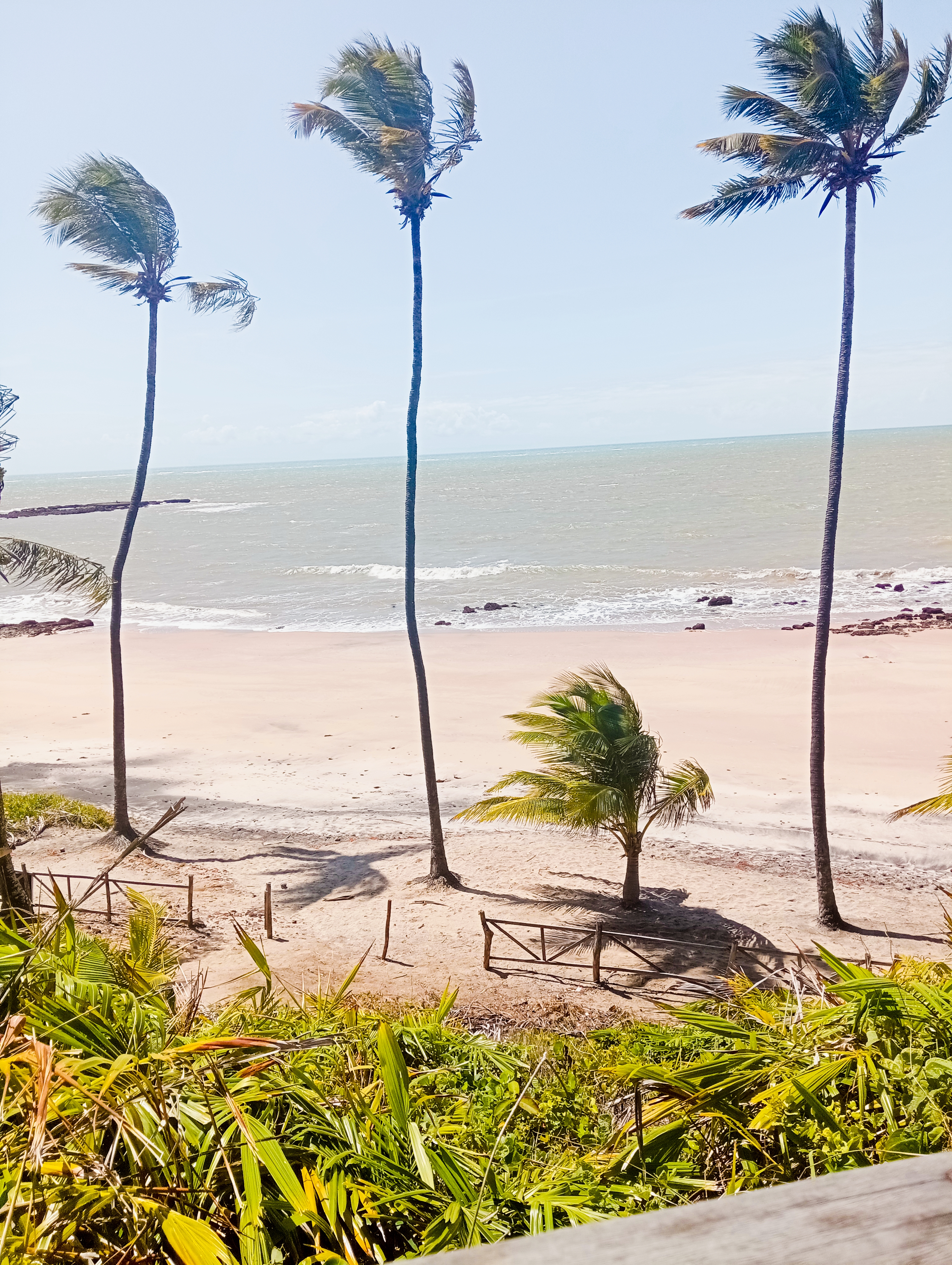
This is part of Brazil's northeastern barrier coast, with an average elevation of only about 16 meters. Coastal dunes and wind-tolerant vegetation line the tropical shore, and tides expose wide flats—a natural classroom for observing coastal dynamics and dune evolution.

Name, history and community

Praia Bela means beautiful beach in Portuguese. Pitimbu's name comes from Tupi-Guarani, tied to the coastal Indigenous tradition. Today Praia Bela is sustained by small beach kiosks (quiosques), fishing families, and ferry boatmen—a living coast where nature and local culture meet.

Overview

Nature and ecology notes

Read the tropical coast through three dimensions: mangroves, marine life, and shorebirds.

Mangroves and estuary ecology

The estuary and intertidal zone host mangrove communities that act as nurseries for many fish fry and crustaceans, and help filter land nutrients while stabilizing the shoreline. Watching the prop roots and fiddler crabs is a good entry point to coastal ecology.

Marine life and reefs

The open sea side is cooler with stronger waves; reefs and nearshore rocks give barnacles, snails, small fish, and turtles space to attach and feed. The warm river is better for calm swimming and snorkeling. The two water bodies together support rich nearshore biodiversity.

Shorebirds and dune plants

The tidal flats and estuary are important stopovers for migratory waterbirds; at low tide you can watch sandpipers, gulls, and shorebirds feeding. Dune plants such as purslane, cacti, and salt-tolerant grasses use deep roots to anchor the sand and form the first line of wind protection.

Key facts

Basic spatial and geographic data

The structured data below summarizes Praia Bela's coordinates, administrative status, elevation, hydrology, and tides to help visitors read the place geographically.

Measure
Geographic coordinates
Core Data
Approx. 7°28′S, 34°50′W
Notes
located by Plus Code J52W+R9
Measure
Administrative area
Core Data
Pitimbu, Paraíba, Brazil
Notes
southern edge of the João Pessoa metro area
Measure
Average elevation
Core Data
Approx. 16 m
Notes
lowland of Brazil's northeastern barrier coast
Measure
Distance from João Pessoa
Core Data
Approx. 45 km
Notes
about 1 hour by car via BR-101 / PB-008
Measure
Hydrology
Core Data
river meets sea
Notes
cooler, wavier open sea; warm, calm river mouth
Measure
Tidal pattern
Core Data
semidiurnal
Notes
two highs and two lows daily, moderate range

Access

The arrival route from João Pessoa to Praia Bela

Praia Bela is not a flat city destination but a road-and-ferry river-and-sea arrival. Reading this route helps you understand its spatial logic.

Stage 1 · about 0–40 km

Start: João Pessoa city

Leave João Pessoa on BR-101 south, then turn onto PB-008 toward Pitimbu. The landscape shifts from urban plain to tropical coastal countryside; about 1 hour by car.

Stage 2 · Pitimbu

Transfer: Pitimbu town and the river mouth

After reaching Pitimbu, continue south to the river crossing. Park by the bank and take a local small ferry (balsa) across the river; the crossing takes only a few minutes.

Stage 3 · across the river

End: Praia Bela beach

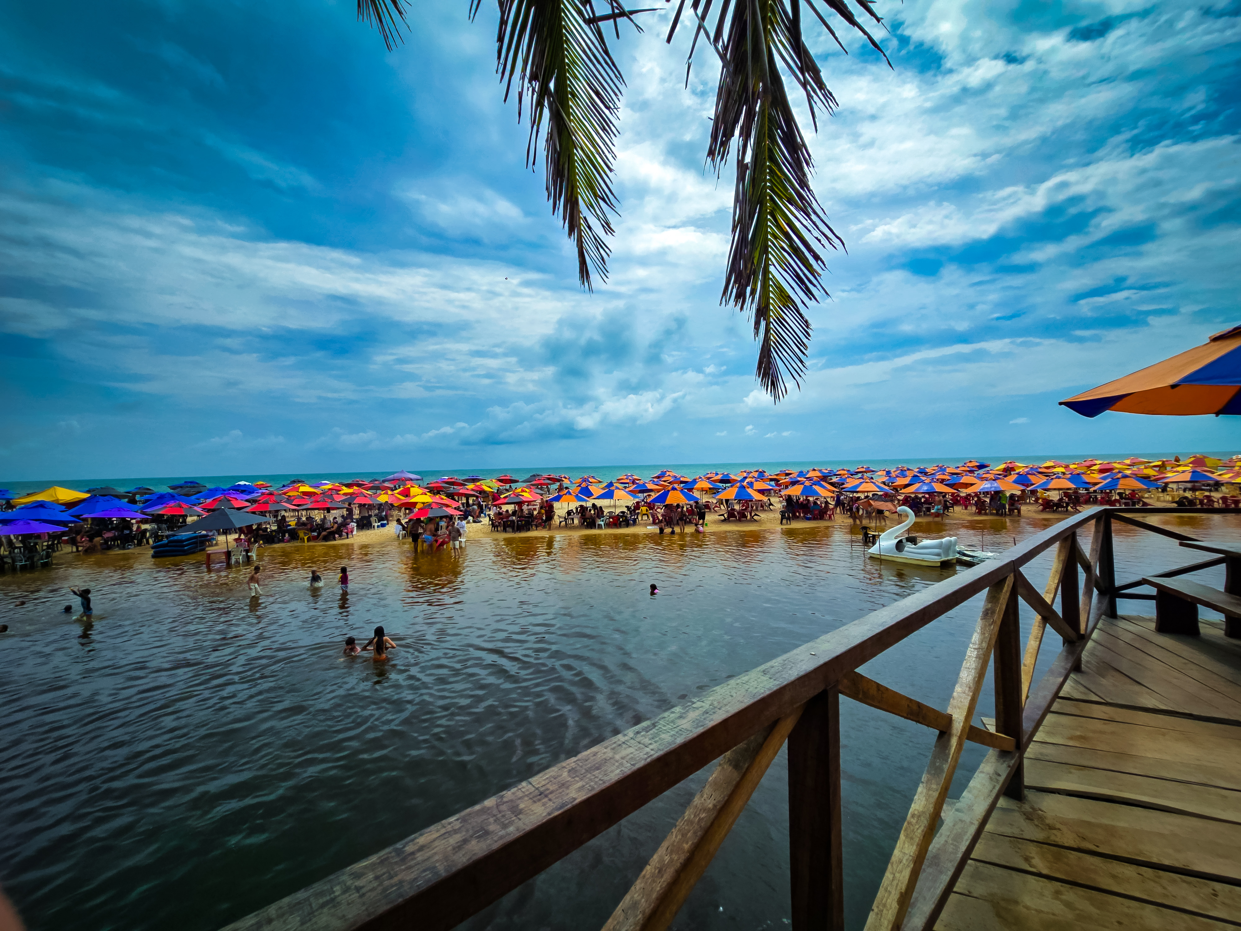
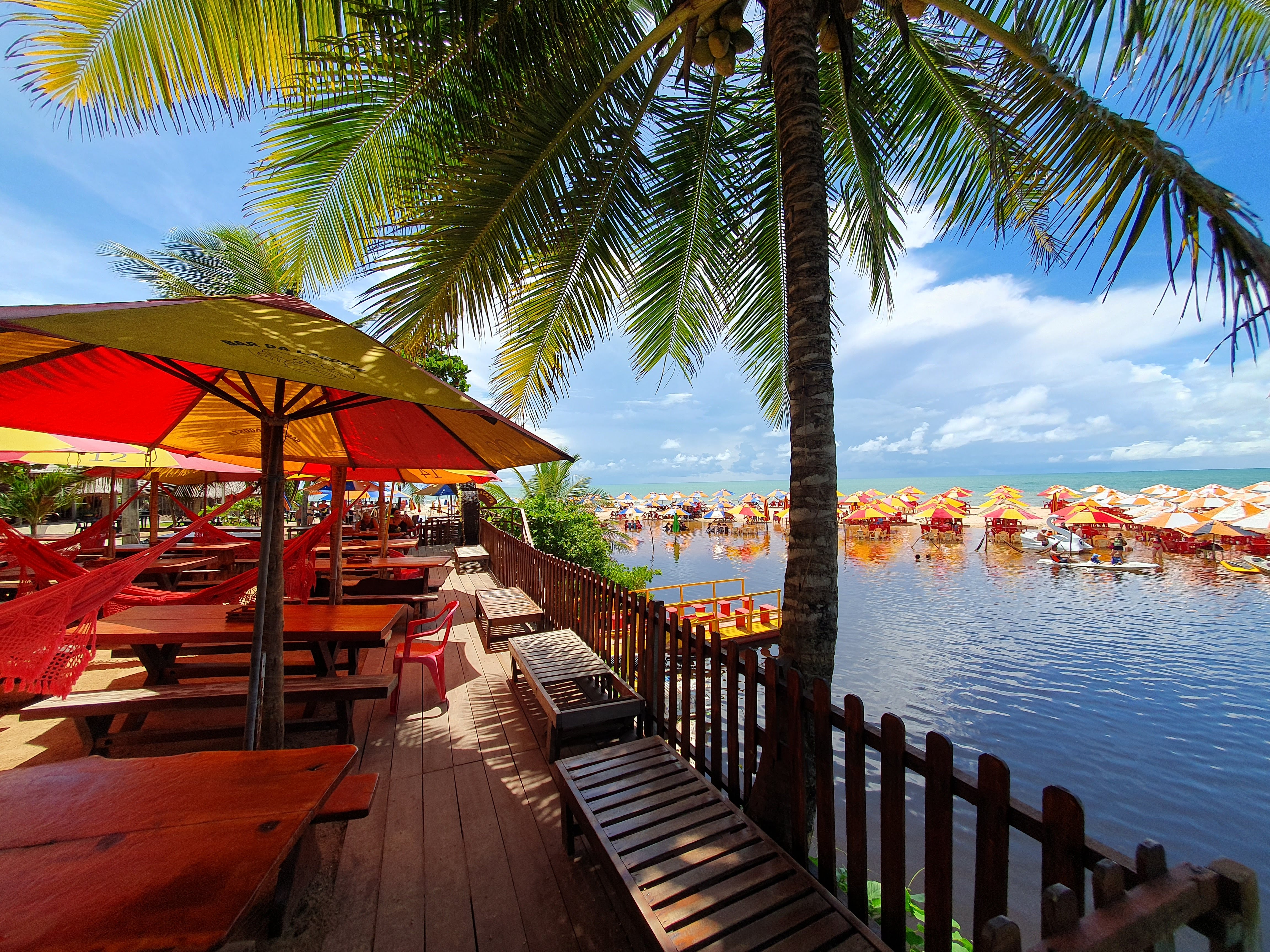
After landing, you arrive at Praia Bela. Beach kiosks, shade tents, and the shallow river mouth sit beside the sand—good for rest, wading, and watching the river meet the sea.

Overview

Tides, climate and best timing

Away from the city, the real value of this coast lies in the rhythm of tides, climate, and light. Understanding them makes a visit more rewarding.

Semidiurnal tide rhythm

This is a semidiurnal tide, with two highs and two lows each day. At low tide, wide flats and rocks are exposed—better for beachcombing, observing life, and walking. At high tide, the sea reaches the dunes—better for swimming and photography. Check the day's tide table beforehand.

Climate and season

The climate is tropical and warm year-round. May to September is relatively dry, with less rain and calmer seas—a comfortable window to visit. February to March is the rainy peak, with frequent afternoon thunderstorms.

Light and photography

Early morning light is soft and the sea is calm, good for shooting the river-sea meeting and tidal life. The golden hour at dusk adds depth to dunes and waves. For photography, timing often matters more than whether it is sunny.

Reviews

Visitor observations

High-frequency visitor feedback is summarized into three concrete reading points to help set reasonable expectations.

View on Google Maps

River-and-sea dual experience

Ratings are closely tied to the rare river-on-one-side, sea-on-the-other layout: the warm river suits wading and relaxation, while the cooler, wavier open sea suits wave-watching and walks—two experiences on one beach.

The ferry ritual

Crossing the river mouth by small ferry feels to many visitors like a slow-paced arrival ritual, and adds contact with local boatmen and community—what sets this coastline apart from city beaches.

Conditions shift with the tide

The experience varies clearly with tide level, wind, and weather: low tide opens wide flats for beachcombing, high tide is better for wading. These variables matter more than a generic claim of beauty.

Access

How to get here

Praia Bela lies on the southern coast of Pitimbu. Usually you first reach João Pessoa or Pitimbu, then finish with a road-plus-ferry arrival.

Regional airports

The nearest major airport is Presidente Castro Pinto International (JPA) in João Pessoa, about 1 hour away. If flights are limited, fly to Recife (REC), then go north on BR-101 and turn onto PB-008.

Self-drive

From João Pessoa take BR-101 south, then PB-008 toward Pitimbu and on to the river crossing. About 45 km total; the final leg requires leaving the car and taking the balsa. Drive in daylight.

Bus plus transfer

Long-distance buses or shuttles reach Pitimbu town. From there take a local community van (comunitário) or taxi to the river, then the ferry. Public service is limited, so note the last departure.

Final ferry leg

At the river, park the car and cross by small ferry (balsa) with your belongings; the crossing takes only minutes. The ferry may shift with weather and tide, so carry cash and watch the return time.
Plan

Plan your visit

Best timing

For photography and tide-watching, prefer early morning or late afternoon. May to September is drier with calmer seas—a more comfortable window.

River and sea together

In the morning, wade and relax in the warm river shallows; in the afternoon, watch waves and walk the open-sea side. The open sea is wavier, so swim only where there is supervision.

Suggested duration

Including the ferry round trip and beach rest, half a day is comfortable; with beachcombing, photography, and nearby coastline, allow a full day.

On-site safety

Tropical sun means sunscreen and water; watch the day's sea conditions and rip-current notices; carry cash for the ferry and kiosks; make sure to catch the last ferry back.

Plan

Structured visitor FAQ

To help you make informed travel decisions, we have organized the most common questions into three core dimensions based on geographical conditions and visitor feedback:

1. Geography and environment

What does the river-meets-sea setting mean here?+

Praia Bela sits on the Atlantic coast of southern Pitimbu, where a small river enters the sea. The two water bodies differ sharply: the adjacent river mouth is warm and calm, good for wading; the open sea is cooler with stronger waves. Reaching the beach usually means crossing the river mouth by a small ferry (balsa).

Why is the sea cooler and wavier?+

The open sea faces the Atlantic directly and is shaped by currents and wind, so its temperature is usually lower than the sheltered river mouth and larger swells appear. That contrast is why it suits wave-watching more than long swims.

What is the scientific value of the mangroves and flats?+

Estuary mangroves are nurseries for many fish fry and crustaceans, while filtering land nutrients and buffering storm surge. The exposed tidal flats at low tide feed shorebirds and bottom-dwelling life—a natural classroom for coastal ecology.

2. Transport and access

How do I drive to Praia Bela?+

From João Pessoa take BR-101 south, then PB-008 toward Pitimbu and on to the river crossing. It is about 45 km, roughly 1 hour. The final leg requires leaving the car and taking the ferry, so note its operating hours.

Can I get there without a car?+

You can take a long-distance bus or shuttle to Pitimbu town, then a local community van (comunitário) or taxi to the river crossing, and finally the balsa across. Public services are limited, so plan your return time in advance.

What should I watch for with the ferry (balsa)?+

The ferry is run by local boatmen. Schedules are fairly regular but can change with weather and tide. Carry cash for the fare and note the last crossing so you are not stranded on the far side.

3. Safety and visitor tips

Is it suitable for seniors and children?+

The beach itself is gentle and good for family rest, but the open sea is wavier, so children should stay in the shallow river area or supervised spots. Those with limited mobility need help boarding the ferry—judge by your own ability.

Should I worry about jellyfish or rip currents?+

Tropical coasts can have jellyfish and rip currents. Enter the water only where there are lifeguards or other people, watch the day's sea conditions, and avoid flagged or warned areas.

What facilities are on site?+

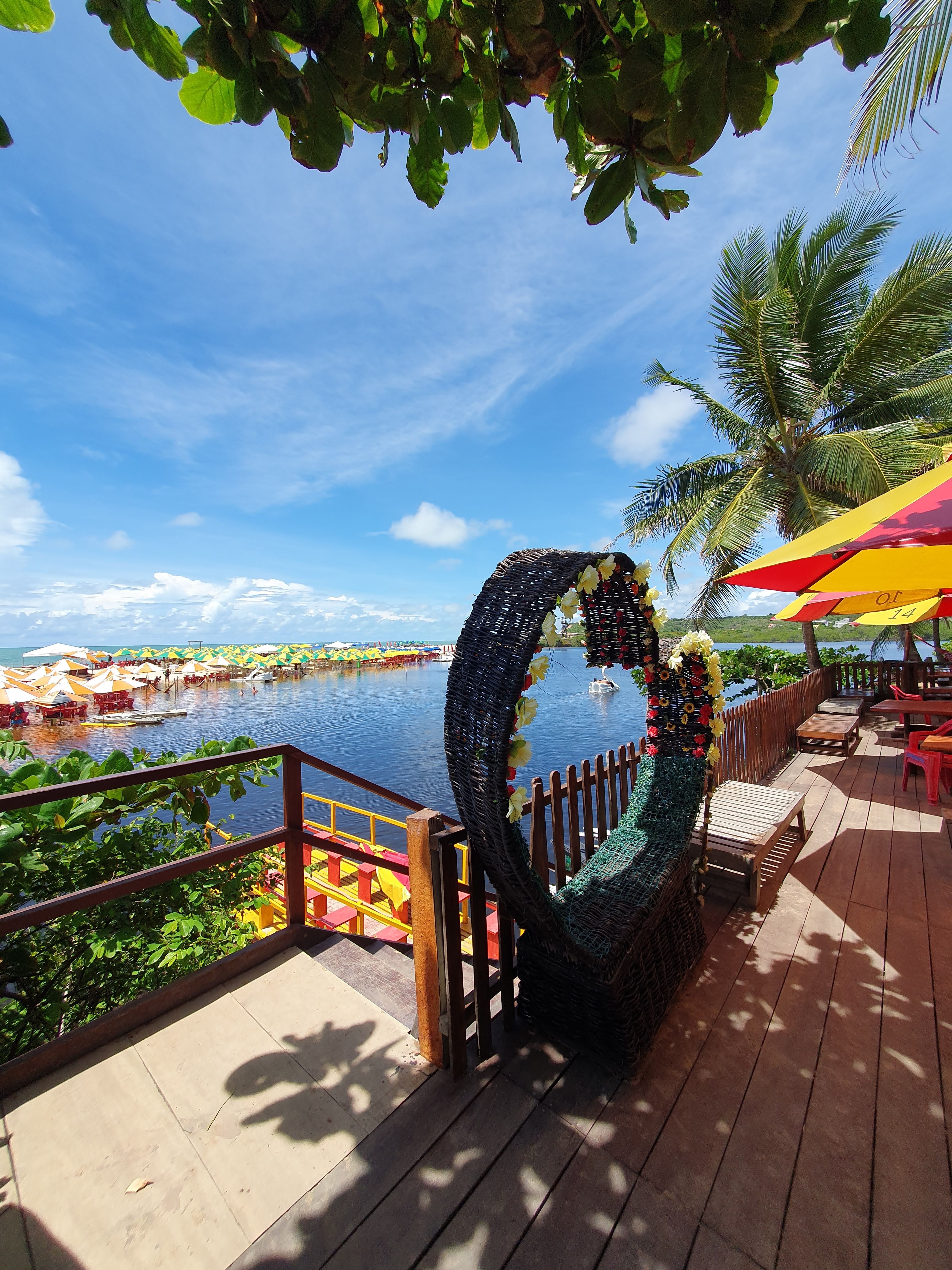
Small beach kiosks (quiosques) offer shade, simple food, and rest. Medical care and banks are mainly in Pitimbu town and João Pessoa. Bring your own water, sun protection, and some cash.